

Copperas Falls Trail (Unofficial) | 3.25 Miles
Copperas Falls Trailhead (Unofficial) | KY-715
Copperas Falls Trail Map | Alltrails
Red River Gorge Trail Map | U.S. Forest Service
Drive over to the Red River Gorge on any given day throughout the year and you can be sure to find parking lots overflowing with cars and trails full of happy hikers. As fun as it may be to mingle with other fellow nature lovers, there is something to be said for enjoying some solitude while out in nature. The best time to take in all of the beauty the gorge has to offer, while not having to fight over a parking space, is during the dead of winter. On this occasion, one of my all time favorite destinations to explore, especially after a good dusting of snow, is Copperas Falls. While it lies along an unofficial trail that follows the tributary of Copperas Creek, its well worn path is easy to follow and currently in the works for possibly becoming the next official trail at Red River Gorge in 2023. Along with the Cloudsplitter to Indian Staircase Loop, these are two of the most popular and sough after Unofficial Trails in the area.
For those planning to visit the gorge after a heavy snowfall, a good rule of thumb is to enter it through the Wolfe County side near Rockbridge. Wolfe County goes out of their way to clear the roads and make sure they are safe and open to hikers year round, despite the weather conditions. On this particular outing, I worked out a plan to visit Copperas Falls and a few of the sights along the trail including Hopewell Arch, Cookie Falls, Snow Arch and Double Deer Arch. Red River Gorge and the Daniel Boone National Forest are packed with arches of every shape and size that most casual visitors will never get the joy of seeing without going off-trail. These sights are all located on the western bank of Copperas Creek, with a whole other set of waterfalls and arches located on the eastern bank, but that’s for another trip. While I’ll be recounting my experience of how I reached these landmarks, getting to them can be quite dangerous so I will not be giving out any specific information on how to find them. So do not use this information alone as a way to find them. With that being said, there are countless of resources on the internet where experienced off-trail hikers can gather GPS coordinates, maps, and general descriptions to where these sites are located. Let’s get started!

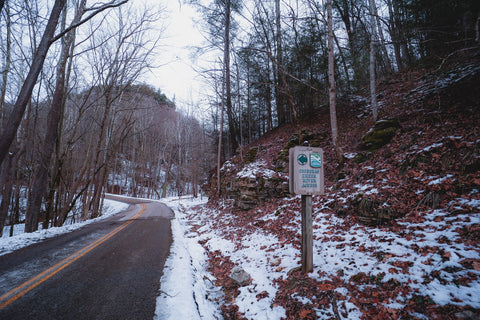
Copperas Creek Trailhead (KY-715)
Parking in the Osborne Bend Trailhead parking lot, I was pleased to find it completely empty. It’s a rare occasion to have any part of the gorge to yourself. With snow gear in tow, including some crampons I purchased specifically for this outing, I walked the 20 yards north along KY-715 to where the road meets Copperas Creek. The trailhead is impossible to miss, especially with all of the signs for the Copperas Creek canoe launch letting you know exactly where you are. Looking up the main tributary of Copperas Creek, you can easily spot the well worn trails on the east bank, even under all of the hard packed snow. Along the entire 3.25 mile stretch, this trail will weave from the east bank to the west bank roughly 9 times. Since it is an unofficial trail this means that there are no bridges, so we will be fording the stream in places with the lowest water levels and even utilize some downed trees to keep our feet dry.

With temperatures fluctuating between freezing and thawing, it has created a unique effect of freezing the surface of Copperas Creek into a solid sheet of ice, while the water just beneath the surface continues to flows. In a few spots, the ice is thick enough to support my weight while I walk over it like an observation deck. In other spots, my foot breaks straight through the ice creating the loudest crashing sound I’ve ever heard as it echoes through the valley. Every surrounding cliff is sparkling with icicles, some larger than a grown adult. When you spend some time away from the gorge, you tend to forget that it has a very distinct woodsy/musky/sweet scent that once I breath in I’m reminded that I’m home. At about 1 mile in, I spot one of the main landmarks along this trail, Big Marge. This enormous two story tall boulder lies smack in the middle of the creek over a stack of smaller rocks, creating a tunnel that hikers often pass through. It is also a favorite spot for kids to play hide and go seek in. This site also happens to mark the beginning of the passage to Hopewell Arch. Just past this mark a small, but well traveled off-trail path meanders west towards the base of the cliffs to see this famous waterfall arch.

Hopewell Arch (-37.82716,-83,57786)
Bushwhacking my way up the hillside, I reach an old and overgrown forest service road intersecting a smaller path heading further uphill to Hopewell Arch. At only 0.15 miles, the trail to this arch is fairly easy until you reach the cliffs just below it. Here, things quickly get dangerous as the hiking turns into scrambling. Throw in a little ice to make the surface slick and things get dicey pretty quickly. Searching out flat spots in between the large boulders for better footing, I slowly traverse this first obstacle and reach the base of the cliffs. Looking up at the crest of the ridge, I can almost make out the cove where Hopewell Arch resides. There are two separate paths that lead up to the arch, but the easier of the two is impassable due to a thick sheet of ice covering the hillside. This means I’ll be scrambling up the more difficult route. A narrow path hugging the imposing stone wall leads up to a series of ledges that gets harder to scramble the closer they get to the top.

As a final obstacle to challenge my worthiness to see this majestic sight, the final ledge requires one to lift themselves five feet vertically, with the aid of a tree trunk, to reach the arch. Ducking through the small cave that guards the entrance, I push my way past a hedge of rhododendron and step inside Hopewell Arch. This arch has been on my bucket list for many years and standing within it overwhelmed me with excitement. Each circular ledge of the cavern was filled with enormous icicles making Hopewell Arch glisten in the sunlight like a crystal chandelier. The first thing most people notice about Hopewell Arch is that it is in fact a double arch. Just above the natural bridge creating the main opening is another arching cave and rock shelter. Enough water was streaming through the bridge above to remind visitors that this is in fact a waterfall during periods of heavy rain. Back in 2020, Backpacker Magazine featured Hopewell Arch in an article praising Red River Gorge and ever since then the floodgates have opened wide with hikers trying to find this location.

Buzzing with energy and excitement from my first find, I headed back to Copperas Creek towards my next destination, Cookie Falls. This secluded waterfall is wayyyy off in the sticks on one of the many tributaries feeding Copperas Creek. As of this writing, it is 1 of 5 known waterfalls at least 40 feet or taller within the area. Without a GPS the best way to locate it is by finding the tiny stream emanating from the tributary just north of Hopewell Arch and hiking west to the head of the canyon. Despite having a well trodden trail to it, I was unable to find it so in good old fashion backwoods exploring, I began to follow the curvature of the cliff while bushwhacking my way through the dense forest. There are tons of smaller wet weather waterfalls in this area and with the suns rays melting the snow covered hillside, I had to double check each step as the ground beneath me was constantly giving way to slippery mud. With very few pictures to be found of Cookie Falls, I was constantly second guessing wether I had found it. Hoping that I would eventually just run into it, I kept following the ridge line until I could barely make out a large space at the end of a long tunnel with the faint sound of water just beyond that.

Cookie Falls (-37.8309,-83.5799)
Pushing my way past some brush and debris, I stepped out onto a ledge of stacked boulders to find that I am smack on top of Cookie Falls at the head of a wide canyon. In all of the confusion while trying to bushwhack my way in, I somehow ended up on the far left corner of the Cookie Falls rock shelter, way up near the top of the cliff. It had to be one of the best views I’ve encountered in the Copperas Creek area thus far. At the bottom of this plunge style waterfall was a large ice cone. Water would fall into the frozen chute and travel beneath a sheet of ice and snow before reappearing twenty feet downstream. Scanning the cliffs opposite the falls, I could make out the dark opening of a cave high up on a ledge. This is the cave behind Double Deer Arch and Snow Arch, which helped popularize Cookie Falls other nickname, Under The Arches Falls.

After doing a little more exploring in the rock shelter below Cookie Falls, I finally found the well worn trail leading out of the cove and followed it downstream to my next objective, Snow Arch and Double Deer Arch. To reach them requires walking out of the southern fork of this small tributary and working your way to the north fork. Keeping my eyes glued to the ridges high above for any sign of a dark opening, I began the steep scramble up the hillside. In this part of Kentucky, bushwhacking takes on a whole other level of challenges when you begin having to wrestle thick stands of rhododendron. Often times when you try to push your way through a hedge, the elastic branches spring back and throw you down to the ground. It can be a slow process with each painstaking step being hard earned.

Snow Arch (-37.83222,-83.57972)
Again as earlier, the closer I got to the cliffs, the less reliable my tracking app became to the point where I was traveling blind. Finding a few faint trails, I began to follow them to various ledges in an area I was sure contained the arches. I kept coming across a whole plethora of interesting rock shelters and cliff overhangs, but still no sign of the arches. Frustrated after what seemed like an hour of searching, I ended my search in defeat. On my way back downhill the way I initially came in, a little voice in my head whispered to look up. That’s when I saw it. With a golden aura of light emanating from the opening, just a few paces above me stood Snow Arch. It was even more beautiful than I had imagined it.

Snow Arch is a cave style arch spanning roughly 17 feet across. The inside of the structure resembles an amphitheater with the opening slanting downwards towards a small overlook at the edge of a cliff. Because of its location facing north to south near the top of a ridge, its chamber is constantly illuminated by light. Anyone out searching for Snow Arch knowns that if they find it, that means they’re only a stones throw away from its neighbor, Double Deer Arch. The only thing standing in the way between the two landmarks is a dangerously narrow two and a half foot wide ledge that spans a six foot long gap in the ridge. A lot of people make it this far and chose to turn back because of just how scary and dangerous this crossing is. It is a straight twenty foot drop if you were to fall that could lead to major injuries if not certain death.

Double Deer Arch (-37.83206,-83.58007)
Walking across this section is not an option because the cliff juts out over the ledge, blocking it off for anyone not three feet tall. So getting on all fours, I slowly began to crawl across the span. Moving my hands and knees in tiny increments so as to not make any sudden jerking movements that would throw me off balance, I cleared the bridge and made it to the other side. Somewhere in the middle of that my backpack got caught on the part of the ridge that juts out, forcing me to finish on a full out army crawl. All of that tension melted away once I caught a glance of Double Deer Arch just on the other side of the cliff. This is one of the most elegant and architecturally interesting arches in Red River Gorge.

It is made up of two separate sandstone arches spiraling over each other. The structure appears to have once been a shallow cave with sections of the back wall eroding away to create the arch openings. The taller arch spans 28 feet over and to the rear of the smaller arch, which curves slightly forward. Glancing at the steep embankment to the left of the arch you can see how the bedrock is actually a part of the entire structure. To get through to the other side of Double Deer Arch and get a better close up view, one has to go through the arch. While some chose to slide under it, it is a local tradition to slide in between the two arches for good luck. Once on the back side, you can get a much better understanding of how the arch stands curve into one another. This ledge extends another twenty feet along the ridge and ends at the small cave visible from Cookie Falls. The cave itself is a fun find containing tons of interesting small formations and could have possibly at one point been used as a prehistoric dwelling.

Leaving Double Deer Arch back the way we came in, we descend from the bluffs to reconnect with the main trail at Copperas Creek. From here it is another 1.5 mile trek to Copperas Falls. All of the creek crossings on this trail are back loaded on the final stretch of our journey. No one side of the creek goes all the way to the falls. You might find a nice long stretch of trail to walk on for 15 to 20 minutes and then suddenly come to a dead end, realizing the trail continues on the opposite side of the creek. While the creek is low enough in some spots simply find stones to skip across, a few sections require walking across downed trees. One of my favorite crossings is along a very large downed log that has been worn smooth over the decades its been walked across. The entire top of it was packed with hard snow, making the crossing smooth and seamless.

Copperas Creek Falls (-37.84108,-83.57132)
On some of the stretch of trail located on the eastern bank, make sure to look up at the cliffs and see if you can spot any of the caves, arches, or waterfalls hidden here. On a future trip to Copperas Falls, I’ll be searching for Copperas Arches 1,2,3 and another arch with a waterfall streaming through it, Sandy Arch. Near one of the final creek crossings you’ll pass in front of one of the loveliest falls on this creek. This unnamed cascade has a popular picnic spot right beside it that I stopped by to grab a quick lunch. To be honest, at this point I was so worn out that I could have just spent the rest of the afternoon simply admiring the serene winter seen at this spot and left a happy man. With only a little left to go, I found the energy to continue on towards the our last waypoint for the day.

The approach to Copperas Falls is hidden behind a complex of boulders and fallen trees, but the sound of crashing water is loud enough to elude to its location straight ahead. Weaving through the obstacle course of debris, it is not until you reach the path squeezing in between two towering blocks of sandstone that the top of the 43 foot falls comes into view. Surrounded by a hedge of rhododendron, Copperas Falls suddenly appears like a hidden oasis. With a turquoise blue lagoon at the bottom of the falls, how could this be anything other than paradise. The massive rock shelter behind the falls is one of the largest in Red River Gorge. From the rock fall on the far left corner to the overlook on the far right side, you can spend an entire afternoon simply admiring this site. While this rock shelter is a known archeological site, I searched up and down for hominy holes on some of the bedrock and boulders, but came up empty handed.

In 1996, the Forest Service conducted an archeological survey of the 400 acres of land within the Copperas Creek drainage and found an astounding amount of evidence that prehistoric Native Americans at one point resided here. It is widely believed that some of the earliest people to live in Red River Gorge belong to the fabled ancestors of the Fort Ancient Culture, known as the Adena People. The definitive proof that people lived in the shelter below Copperas Falls was the discovery of prehistoric ceramics that are only found in sites inhabited for extended periods of time.

For this very reason Red River Gorge holds a unique space within Kentuckys public land system as a living museum. With so much to explore here, this trip is just the tip of the iceberg when it comes to all of the unique sights of the gorge. Stay tuned as we head across the Ohio River to search for frozen waterfalls within the canyons of Yellow Birch Ravine Nature Preserve in Taswell, Indiana. As always, see y’all on the trails!


0 comments