

Mantle Rock Trail | 2.75 Loop
Original Route | 1.0 Mile
Mantle Rock Trail Map | AllTrails
Mantle Rock Nature Preserve Location | Google Maps
Visiting Mantle Rock had been on my bucket list for quite some time and I found the perfect opportunity to make a stop here on the tail end of my tour of the Shawnee National Forest in Southern Illinois. Mantle Rock is one of those areas that is not well known outside of the state of Kentucky, yet is considered a treasure trove of archeological and historical heritage on a national level. For arch hunters out there, Kentucky boasts the 5 largest arches in the Eastern United States which includes Mantle Rock, Natural Arch, Natural Bridge, and Creelsboro Natural Bridge.

Located in rural Livingston County near the banks of the Ohio River, roughly 45 minutes north of Paducah, this is not an easy place to get to. Winding through backcountry gravel roads past seas of ochre blooming canola, we arrived at the compact entrance of the 367-acre Mantle Rock Nature Preserve. An official map of the preserve detailing the 2.75 mile loop can be found at the trailhead or on most hiking apps including AllTrails. The loop is separated by two distinct portions; the Main Loop (Blue) and the Original Route (Red).

Trail of Tears (Original Route)
Much of what is now within the bounds of the preserve belonged to the Reynolds Metals Company until 1988, when they donated an initial 190 acres to establish the preserve. The park grew to its current 367 acres in 1995 after several acquisitions by the Calendar Tract and Felburn Foundation. Though the area had a mixture of user made paths leading to its famed natural arch, a trail system had not been formally established until the early 2000’s. Upon receiving recognition as a certified site along the Trail of Tears National Historic Trail in 2004, The Nature Conservancy in conjunction with a partnership with The National Park Service began work on a retracement hiking trail to highlight the nature preserve’s cultural history. In 2010, they unveiled an exhibit that extends all along the preserves 2.75 mile loop, detailing historical accounts of the Cherokees visit to Mantle Rock during the winter of 1838-1839. In total, there are 5 officially recognized stops in Kentucky commemorating the Trail of Tears; Grays Inn, Hopkinsville Park, Big Spring, Mantle Rock, & Berrys Ferry.

Upon spending a few moments examining the exhibit near the trailhead, we began our exploration of the Mantle Rock Nature Preserve by walking along a retracement of the Trail of Tears. This well defined and wide berth trail is actually an ancient roadbed utilized by early Native Americans and later used by frontier settlers as a wagon road. Marked as the Original Route (Red), this 1 mile trail follows in the exact footsteps of 11 detachments containing more than 10,000 Cherokee whom were forcibly removed from their homes in the wake of the Indian Removal Act of 1830. Until visiting this site, I was under the wrongful assumption that the Trail of Tears was just one singular trail. In fact it is made up of nearly a dozen distinct routes, with almost just as many different tribes involved in the march that included people from the Cherokee, Muscogee, Seminole, Chickasaw and Choctaw Nations. The 2,200 mile path formally known as the Northern Route transported Native Americans on a forced march from Fort Cass, Tennessee to Westville, Oklahoma.

Mantle Rock Arch
After a short walk, you’ll encounter a trail junction with the Mantle Rock Loop veering south to Mantle Rock Arch. Nearly a 0.50 mile down this path, we encounter the shaded entrance of Mantle Rock. From the outside looking in, the space appears to be a small cave until you step through the trees and enter the wide mouth opening of the alcove. To date, this is one of the most perfectly rounded and daintily shaped arches I’ve had the pleasure of visiting. Hidden by the lush forest surrounding the bluff line, it is best viewed during the winter months. A search through the Kentucky Historical Society archives yielded a postcard of the arch from 1913, showcasing it as a well known tourist attraction. Labeled as Natural Bridge, the color photograph clearly shows the entire span and cave opening at a time when this forest had been logged.

The most iconic part of this arch has to be the tree growing through the 30 foot tall ceiling in the center of the alcove. If you visit near noon when the sun is directly overhead, you’ll get a chance to see a gorgeous glowing ray of light pour in through the skylight above. During one particular account of the Trail of Tears Northern Route, the Peter Hildebrand Detachment, consisting of 1,766 Cherokee, were forced to camp at Mantle Rock for two weeks. Waiting for the frozen Ohio River to thaw in order to cross from Berrys Ferry, Kentucky to Golconda, Illinois, many sought refuge under the arch to escape the bitter blizzard like conditions. Eye witness accounts from settlers in the area reported seeing a wagon train of mules, horses, tents and people that stretched for over 2 miles across the frozen landscape. Legend has it that burials were conducted under Mantle Rock, but a careful archeological study conducted by the National Park Service found no evidence to support that.

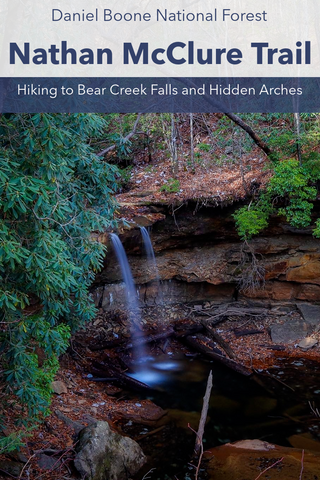
While Mantle Rock Arch is definitely a highlight of the preserve, there is a lot more to see along the 2.75 mile loop. Continuing past the arch, the trail ducks under a long stretch of towering cliff overhangs to a small bridge spanning one of several freshwater springs emanating from the top of Mantle Rock. Some of these even turn into spectacular waterfalls after a hard rain. Just look for the small foot paths leading towards the sound of water to find these hidden treasures. Containing a biological diversity not seen anywhere else in the region, this area is known for its spectacular springtime wildflower display. After tackling a scramble up a steep rock face, we reach the upland forest of the preserve containing some of its more sensitive ecosystems.

One of the best example of rare and fragile sandstone glades and barrens found in all of Kentucky exists atop the escarpment surrounding Mantle Rock. They were created over thousands of years along the exposed bluffs were vegetation and exposure to the climate have slowly broken down the sandstone into a thin layer of sandy soil layered over hard stone. Within the preserve, these fast draining and relatively drier micro habitats have become homes to drought-tolerant plant communities containing prickly pear cactus, rush foil, hairy lipfern, little bluestem, pigweed, and poverty grass. In the summer of 2019, The Kentucky Native Plant Society conducted a detailed floral inventory of the glades, barrens, woodlands, and mesic forests of Mantle Rock in order to locate, identify, and document all of the significant plant species within the preserve. All of the information collected by some of the regions preeminent botanists will be used by The Nature Conservancy to develop a comprehensive and long range management plan for the preserve.

Southpaw Rockshelter Site
As the trail nears the banks of McGilligan Creek, it enters a tight squeeze through a field of large boulders that were once part of the cliff before breaking off. Zigzagging our way through and over the rocks, our path leads us under another towering rockshelter with a prehistoric past. Known as the Southpaw Site, this cliff overhang was once home to early Native Americans between 500-700 C.E. Mantle Rock has long been famous for its rock art site containing petroglyphs of a turkey and fish. Difficult to pinpoint and a closely guarded secret, I had trouble locating the rock art to see it for myself, even after hiking the loop twice. Evidence of prehistoric people living and hunting through this valley has been found in a handful of sites bordering the entire stretch of McGilligan Creek and its tributaries, especially within the boundary of Mantle Rock. Unlike most of the muddy streams in this part of the state, McGilligan Creek stands out for its exceptionally clear waters which are filtered through a bed of fine sand. Livingston County as a whole is revered for its pristine bluff habitats and is still to this day a preferred hunting ground for waterfowl, turkey, deer, and small game.

Due to its proximity to the confluence of the Ohio River and Cumberland River, this was a place that saw lots of activity not just during pioneer times, but prehistoric as well. Just 13 miles north of here is the famed lost city of Tolu surrounded by a complex of ceremonial earthen mounds. The "Tolu Site" has long been known as a treasure-trove for relics of the Mississippian culture that thrived through much of there Ohio River Valley from 1200-1450 C.E. Arrowheads, pottery shards, stone tools, and other items turn up frequently when neighborhood fields are plowed. The site was thoroughly excavated and studied in the summer of 1930 by famed Kentucky archeologists W. S. Webb and W. D. Funkhouser of the University of Kentucky. Continuing our hike along the stream, we pass up a handful of boulder strewn cascades and turquoise blue swimming holes that evoke similar streams found in the Great Smoky Mountains.

Joy Falls
Speaking of waterfalls, no stop here is considered complete without heading over to see Joy Falls. Also known as Mandy Falls by locals, this photogenic waterfall is located on the far western edge of the preserve. After finishing up the 2.75 mile loop, we turned LEFT out of the parking lot and drove a 0.16 mile to the pullout overlooking the falls directly on Lola Rd. A short stroll over the exposed bluffs along the northern stretch of McGilligan Creek will reveal a series of drops that culminate into one wide-mouthed waterfall. During the hot summer months, visitors and locals alike can be found wading in the large natural pool below the falls or having a picnic beside the stream while enjoying the serene surroundings. There is so much to take in within the Mantle Rock Nature Preserve that it deserves more than just one visit.

Having been unable to locate the Mantle Rock Petroglyph Site or view one of the smaller handful of arches found here, I’ll have to plan a return trip in the near future. Up next, we’ll be heading south into Tennessee to travel along its famed waterfall highway. Tennessee State Route 111, stretching from the Kentucky state line to Chattanooga has access to more waterfalls per capita than nay other part of the state. With giant splashers located within Cummings Falls State Park, Rock Island State Park, Burgess Falls State Park, Falls Creek Falls State Park, and the Lost Creek State Natural Area just a short jaunt away from your car, theres literally no excuse to not go out and see them all. Stay tuned for our upcoming series all of these state parks and as always, see ya’ll on the trails!
Sources;
Mantle Rock Exhibits by The National Park Service


0 comments