

Indian Creek Shelter Trail | 0.7 Mile Loop
Giant City Nature Trail Loop | 1.0 Mile Loop
Devils Standtable | 0.3 Miles
Stone Fort Trail | 0.3 Mile Loop
Giant City State Park Trail Map
Giant City State Park Location | Google Maps
No trip to Southern Illinois can be considered complete without paying a visit to one of the most popular parks in the state, Giant City. On a recent trip to the western half of the Shawnee National Forest to explore Pomona Natural Bridge, Piney Creek Ravine, and Fern Clyffe State Park, we decided to make a pit stop in the historic village of Makanda to see this gem of a park. The Village of Makanda sprang up out of the dust in the early 1800’s as a camp for the Illinois Central Railroad. Named for a local Native American Chief, the town has a rich history spanning from the 19th to early 20th century. Residing a few minutes drive from Southern Illinois University in Carbondale, Makanda has slowly transformed itself into a thriving artists colony featuring rotating works of arts along its main boardwalk. Every year, the town celebrates the arrival of fall with its annual Vulture Fest, featuring live music, food, and an art exhibit.

Attracting 1.2 million visitors annually, people flock to Giant City State Park to marvel at its unique sandstone formations filled with massive rock shelters, towering hoodoos, and intricate canyon mazes. Home to its own dedicated nature preserve, visitors can also chose to explore the Fern Rock Nature Preserve via the 1.3 mile Trillium Trail, located near the parks main entrance. With 8 different hiking trails spanning over 15 miles throughout the park, it can easily become an overwhelming task to figure out which trails to see. For this reason, we chose to spend our day focusing on the 4 most visited trails here; Indian Creek, Giant City, Devils Standtable, and Stonefort. Totaling roughly 2.3 miles, most of these hikes are short, family friendly strolls that highlight the parks pristine natural setting while also exposing visitors to some of the areas unique history.

Indian Creek Shelter Nature Trail (0.7 Mile Loop)
After paying a visit to the parks Visitors Center to grab a map and familiarize ourselves with the area, we began our series of hikes by heading over to the Indian Creek Shelter Nature Trail. The highlight of this 0.7 mile loop is a horseshoe shaped shelter bluff located along the banks of Indian Creek which was once inhabited by prehistoric Native Americans. Indian Creek is one of many intermittent streams that criss cross the landscape of Giant City, flowing nearly 15 miles north to Carbondale before making a u-turn south, back to the park. Though usually not more than a few inches deep, during a heavy downpour this stream can grow to be 100 feet wide. Once on the trail, a small “Y” intersection splits off into the main loop, with the RIGHT path being the shortest route directly to the shelter cave. Situated deep in a second growth forest, this is one of the best trails for viewing wildflowers, especially during spring.

There are 5 bridge crossings along this trail with the 2 largest spanning over Indian Creek itself. On a hot summers day, kids can often be seen playing in the clear stream, chasing miniature stream fish and crayfish. There are six native species of crayfish found throughout Illinois, with the most common being the devil, digger, and prairie crayfish. When not scavenging along the bottom of rocky streams, they can often be found by searching for their tall burrows made of mud. Near the halfway point for the loop is where you’ll encounter this trails namesake feature, the shelter bluff. From 400-900 C.E. prehistoric Native Americans from the Lewis Phase occupied this shallow cave. This advantages spot near a source of fresh drinking water gave them a perfect place to centralize their efforts in hunting and foraging for food in the surrounding forest.

If you walk along the drip line below the cliff, you can still find broken fragments of chert used for making weapons and tools. Standing out amidst the dull earth tones, these bright red and white flakes of “Clear Creek Chert” were quarried eight miles away and brought in along an extensive network of trading routes utilized by early peoples. Though Giant City is not known for having large waterfalls, with the exception of Red Cedar Falls, a substantial one can be seen cascading directly over the center of this cave shelter after a heavy rain. Stepping into the space, you’ll notice that the shelter is made up of a lower and upper level, with the uppermost reached via a quick scramble up several ledges. We finish off the rest of this gentle stroll through the woods admiring the blooming trillium, phlox, and bright yellow flowers of the tulip poplar on our way back out of Indian Creek.

Giant City Nature Trail (1.0 Mile Loop)
From the Indian Creek Trailhead, we drive down Rte 51 as it loops around the Giant City Observation Tower and Lodge on our way to the Giant City Nature Trail. Located in the heart of the park, the Giant City Lodge is only one of four state park lodges in Illinois and is often rated as one of the more beautiful Works Progress Administration projects completed in the Midwest. Constructed by the Civilian Conservation Corps during the Great Depression, the camp style structure utilizing local sandstone and towering white oak timber is a nod to the areas pioneer history. Beside it is the Giant City Observation Tower, fit with a spiraling staircase ascending to a platform with panoramic views of the surrounding Shawnee Hills. A short distance away, we pull into the picnic area and trailhead for the Giant City Nature Trail.

Considered the crown jewel of the park and one of the best hikes in Illinois, the 1.0 mile long Giant City Nature Trail is packed with picturesque and awe inspiring scenery. The main feature here is a series of towering bluffs that have eroded away to create narrow canyon passageways known as “the giant city streets”. Built by the C.C.C. early in the parks history, this site surrounding the trail had already been a local attraction beginning with some of the areas first inhabitants. Back when mountain lions and black bear hunted in these very woods, prehistoric humans took shelter under several of the cliff overhangs along this loop including the deep cave near the trailhead. According to Native American lore particular to Southern Illinois, the massive structures were created as the result of a battle between the sun god and water god.

As pioneers began arriving in the area, their disbelief at encountering the massive sheer bluffs inspired the legends of giants living in the forest of Southern Illinois, hence the name “giant city”. Walking the length of the boardwalk, we hit what looks like a dead end at the far side of a slot canyon. But in fact, if you continue towards the face of the 90 degree stone wall, a narrow passageway known as “fat mans squeeze” will appear on your right. This is the entrance into the city streets. Even today, these monolithic structures made of sandstone could easily pass for something man-made, with their smooth surfaces and perfectly cut lines. The key to its creation lies below ground in the bedrock. This giant hill of sandstone sits atop a fragile and slippery surface called Drury shale. Past earth movements and the melt water of glaciers from 12,000 years ago have aided the sliding of sandstone on the slippery shale to leave narrow canyons between the bluffs. Geologists also attribute the stones smooth surface to erosion caused by acidic rainwater.

All throughout here, the C.C.C. erected stone steps leading up through different channel along the top of the bluffs that can still be accessed today. Continuing through the stone halls in a zigzag pattern, a narrow staircase leads out of the canyon through a small channel underneath Balanced Rock. If you take a moment to scan the wall leading up to Balanced Rock, you’ll spot a handful of the dozen historic carvings found along the city streets. Found here and at the entrance to the canyon are the names of the areas first pioneers; Albert S. Thompson and T.W. Thompson, 22 February 1862. These young men were home from their respective units during the Civil War and stopped to visit a boyhood haunt to carve their name. Theodore “T.W.” Thompson was serving as a captain under Colonel John A. Logan’s command during the decisive victory at the Battle of Fort Donelson, which forced the Confederacy to give up southern Kentucky and much of Tennessee to the Union.

Past Balanced Rock, we walk past another sheer cliff with a very interesting rock formation hidden above the tree canopy. Viewable best during winter when all of the leaves have fallen, the Mushroom Rocks sit high atop the bluffs like a miniature version of the Devils Standtable. Mushroom Rock also marks the jump off\on point for the River to River Trail. Spanning 151 miles from the banks of the Ohio to the Mississippi River, the River to River Trail passes briefly through Giant City State Park as this is only one of four organized campgrounds servicing the trail. Finishing up the short, but scenic loop around the Giant City Nature Trail, we exit out onto Rte 51 and drive a mile north to the Devils Standtable Trailhead.
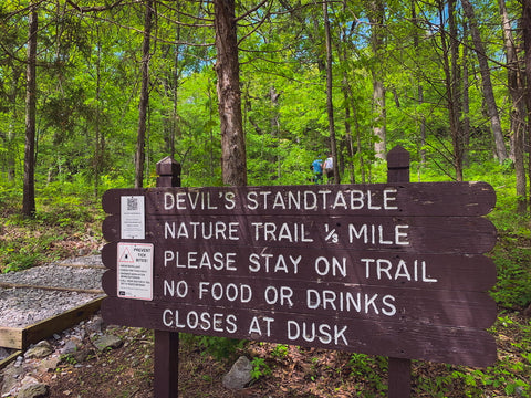
Devils Standtable (0.3 Mile Loop)
If you’re strapped for time, this quick 0.3 mile loop can be done in 7 minutes flat, but you would be missing a lot of finer details that only a leisurely stroll could help reveal. The highlight of this trail is a towering rock formation known as the Devils Standtable. Beginning the loop from the far LEFT entrance, we climb the gravel steps and enter a near pristine example of what this forest might have looked like 220 years ago, before Europeans first settled here. Now a second generation forest, this area was once home to virgin forest with trees that measured 150 feet tall and over 8 feet wide. During the 1800’s, much of Southern Illinois was clear cut by a booming logging industry, feeding the growth of northern cities such as Chicago and Springfield. Some of the surviving 100 foot tall white oaks, the state tree of Illinois, now provide shelter for twenty seven percent of the entire states species of ferns and flowering plants found within the park.

On this particular visit, we could hear the clamor of rock climbers making the slow and arduous trip up the sheer bluffs up ahead. The cliff line running parallel to Devils Standtable is one of two areas open to rock climbing and rappelling in the park. Aside from the bluffs of Shelter #1, Giant City State Park and Jackson Falls are the only two areas open to rock climbing in the entire Shawnee National Forest. Up until recently, climbing was allowed within a small bluff of Ferne Clyffe State Park, but a new park management plan has that access temporarily suspended. As the trail curves to the right, it crosses over a wooden boardwalk at the entrance to the largest rockhouse in the area, fit with a small waterfall. This natural cave shelter is another one of the many prehistoric sites where early humans sought refuge within the wide valleys and narrow ravines of Giant City during the Late Woodland Period.

Measuring roughly 300 feet long and 25 feet high, the deep cave opening is filled with a massive debris field which creates a natural barrier protecting the inhabitants from any danger lurking outside. Mountain lions were common in the area up to the 1890’s and a written account of a young boy killing one with a tree limb on his way to school near Stone Fort Trail can be found in the towns records. Some of the last bear and native elk seen in Southern Illinois were reportedly hunted within the bounds of the park. If you look closely at the interior ceiling, you may spot some of the black soot marks leftover from cooking fires raging over the 500 year span that this shelter was thought to be in use. Follow the drip line and you will see white and red chert flakes just like those found at Indian Creek Shelter.

Caves such as this were later used by deserters during the Civil War. At the far RIGHT end of the trail as it nears the exit, a small path leads to the base of Devils Standtable. Rising nearly 100 feet above the forest floor, it is one of the tallest hoodoos east of the Mississippi River. Taking over 1 million years to form, it was once attached to the cliff wall beside it, until it slipped away sometime during the Illinoisan Glacial Period. The Devils Standtables’ unique shape is attributed to differential erosion, a process where the top layer is more resistant to weathering than the lower layers. Originally called the “mushroom rock”, its uncanny resemblance to a pulpit led locals to nickname it the devils standtable and the name eventually stuck. Facing southwest and remaining mostly dry during winter, the sunlight rich bluffs above the formation are home to a wide array of plants and animals. While rock doves can be seen nesting on the narrow ledges, bank swallows prefer to build mud nests on the face of the cliff. High on the summit, prickly pear cactus, huckleberries, and red cedars compete over every patch of dry soil available.

Stone Fort Trail (0.3 Miles)
Leaving the Devils Standtable, we hop back in our car and drive four miles north along the banks of Giant City Creek to our last hike of the day. Situated on a bluff overlooking the Fern Rocks Nature Preserve opposite the Trillium Trail is the 0.3 mile Stonefort Trail. From the trailhead, it’s a 30 foot ascent up the side of a ravine to reach the Giant City Stone Fort Wall Archeological Site. During periods of heavy rain, the multi ledge ravine becomes a gorgeous waterfall known as the Stonefort Cascades. While dry, a path halfway up the trail leads across the stream to the base of a towering rockshelter opposite the stone fort. Once high atop the sandstone bluff, the trail crosses through an opening in the wall and loops around the interior space of the stone fort. At the southern end of the loop, there are 2 separate overlooks with commanding views of the area.

One of the unique phenomena of Southern Illinois is its ruins of stone walls thought to have been built by prehistoric Native Americans during the Late Woodland Period between 400 C.E. - 800 C.E. Appearing in a rough east to west alignment, they stretch all across the Shawnee National Forest from the Ohio to the Mississippi River. The wall here at the Giant City Stone Fort Archeological Site was at one time 285 feet long, 6 feet high, and 9 feet thick. It fans out across a narrow ridge, protecting an isolated bluff just like the stone fort found at Rim Rock National Recreational Trail. In 2001, an excavation within the fort uncovered a post hole that archeologists believe could have belonged to a shelter. A lack of refuge or artifacts found here suggest that stone fort was not a permanent settlement, but could have been used as neutral ground where various groups could meet, socialize, and trade.

In her book, “Giant City State Park and the Civilian Conservation Corps..”, Kay Rippelmeyer suggests that the location of the regions stone forts might have been due to the fact that they lie just south of the glaciation line and at the northernmost edge of the rugged ridges of the Shawnee Hills. Having little agricultural use, they could have possibly been demarkations of sacred spaces After the last advance of glaciers 12,000 years ago, this would have been the most habitable place for a stretch of over 200 miles. According to historical texts, a commonly used land route connecting the 18th century French fortifications of Fort Kaskaskia to Fort Massac named Lusks Ferry Road passed near this valley, spurring early theories that this could have been an abandoned European outpost. Some even believed it could be a long lost relic of the Hernando DeSoto Expedition from 1541. Though no evidence exists, local legend has it that a one-pound canon was discovered hidden within the stone forts wall by a resident of Makanda.

When early settlers arrived in the valley, they began dismantling what was left of the stone wall to use as foundation stones for their barns and homesteads. In 1854, the Illinois Central Railroad built a line through the heart of Drury Creek Valley, establishing a depot in Makanda, which brought some of the first tourists to the stone fort. During the 1930’s, as Giant City was being created into a state park, the valley below this bluff was home to the Civilian Conservation Corps “Camp Stonefort”. Weighing 50-100 lbs each, workers from the C.C.C. labored to collect the scattered stones and rebuild the wall. It wasn’t until 1956 that scholars took note of the site and began assessing its significance.

Reaching the main overlook at the far end of the bluffs, it leaves little to wonder why this site was chosen. The views from up here are incredible and stretch for miles in every direction. Finishing up our last hike of the day at Stonefort Trail, it seemed like an appropriate place to catch the last few glimpses of sunset from atop these bluffs. If you have the extra time, I highly recommend taking the stroll along the 1.3 mile Trillium Trail within the Fern Rocks Nature Preserve just across the road. The 170 acre preserve was first discovered in 1870 by a French botanist and contains one of the best wildflower displays in the state. Up next, we’ll be taking a short drive east to check out some of the most scenic sights within Fern Clyffe State Park. Known for its majestic waterfall, Fern Clyffe Falls, we will be spending an afternoon tackling three of its most popular trails: Hawks Cave, Big Rocky Hollow, and the Waterfall Trail. Stay tuned as we visit this gem of a park and as always, see y’all on the trails!
Sources;
Giant City State Park and the Civilian Conservation Corps.. by Kay Rippelmeyer


0 comments