

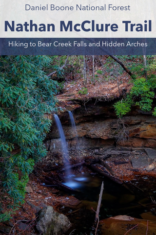
Grays Arch to Hansons Point Loop
- 14 Miles with trip to arches
-8 Miles straight to Hansons Point
Grays Arch Picnic Area Location | Google Maps
Safety Tip: This hike includes some off-trail portions that require advanced navigational skills like the use of map, compass, and gps. The ridge line extending out to Hansons Point has been the site of numerous accidental deaths caused by falls. It is not recommended that children attempt this hike and anyone attempting it should exercise extreme caution.

I first learned of the Grays Arch Day Hike from reading Derek Dellinger’s seminal book, “Americas Best Day Hikes: Spectacular Single-Day Hikes Across the States”. While I had spent many afternoons hiking the short path to Grays Arch and even traversed each of these trails separately at different times, I had never really put them together as a sightseeing experience. While most of the trails in the Red River Gorge are clearly relegated to either deep forested valleys or ridge tops with 360 degree panoramic views, this day hike includes the best of both worlds. Ascending and descending over 2,000 feet in elevation throughout the journey, this is a hike that will test the endurance of even the most seasoned outdoor enthusiast. With all of the added stops to view the 6 arches along this route, our total distance came out to 14 miles. If you skip all of the side trips and do the loop straight to Hansons Point, you can easily cut this day hike down to 8 miles if desired. Alternatively, if you did this trip backwards, it would cut out the strenuous ascents and be mostly a downhill excursion. There are many ways to mix and match this day hike, which is what makes it such a fun adventure worth revisiting.

Descent on Rough Trail to Grays Arch
Grays Arch Trailhead to Grays Arch (1.15 Miles)
The start of this epic day hike begins at the Grays Arch Picnic Area. From here we will hike the 0.25 mile Grays Arch Trail to the Rough Trail junction. Parking spots here get jammed packed on most weekends, requiring you to park at one of the other nearby lots such as Archaic or Pinch’em Tight. The vault toilet at the trailhead is the only restroom you’ll encounter in the 5 hr 30 min duration of the hike so plan accordingly. As a whole, the loop will begin at the picnic area and end 0.16 miles down the road where the Sheltowee Trace\Pinch’em Tight Trail crosses Tunnel Ridge Rd. As an upside, this is one of the few long distance hikes in the Red River Gorge that does not require a shuttle, pick up service, or long roadside walk back to your car.

Rear view of Midstep Arch
Midstep Arch (-37.81803,-83.65770)
Once at the Rough Trail junction, turn Right\North and you’ll be headed directly towards Grays Arch. This wooded ridge extends for a half mile and crosses through a wildflower meadow and under several rock shelters before reaching the well known descent to the base of Grays Arch. There are 2 steep staircases, each with 20 steps, leading down to the valley floor. In between the staircases is a cliff overhang with a hidden arch that many people walk past without ever noticing. Midstep Arch is located directly under the first staircase and all you have to do is turn LEFT after coming down the steps to see it. This arch sits 3 feet high and about 4 feet wide at ground level on the far end of an alcove. After a quick visit to Midstep Arch, continue down the second staircase and keep walking ahead towards the base of Grays Arch.

Grays Arch rockshelter and waterfall along Rough Trail
Grays Arch
While the Rough Trail technically bypasses Grays Arch, we are taking a short detour to visit Papa Bear and Sexton Arch located in a ravine directly behind it. Grays Arch is one of the largest and most iconic arches in the Daniel Boone National Forest rising 50 feet and spanning nearly 70 feet across this narrow valley. I have come here numerous times throughout the years and it is always a worthy stop while visiting Red River Gorge. During the wetter seasons, a massive waterfall streams over the front of the towering rock shelter beside it. At one point in time climbers used to rappel from the top of Grays Arch and this was a popular climbing location. A well known trail once existed taking visitors on a journey over the top of the arch until someone fell to their death from the top (Falls are the #1 cause of death at Red River Gorge and a plaque at the trailhead is dedicated in honor of the victim).

Grays Arch as seen from Rough Trail
As you approach the scramble up to Grays Arch, you should be able to spot a side trail curving out of sight behind the far left pillar of Grays Arch. This is the path you want to take, it is clearly visible once you’re right in front of it. Within 20 feet of walking into this side trail, there is another trail darting off to the RIGHT that descends through a thicket of rhododendron to a wide camping spot and crosses a small stream. After crossing the stream, the trail continues up a ridge line to the base of a sheer cliff. As soon as you reach the cliff wall, there is a path hugging the wall that climbs up the right side. This leads directly up to Papa Bear Arch.

Path leading up from back of Grays Arch to Papa Bear Arch
Papa Bear Arch (-37.81663,-83.65678)
Each and every arch in the Red River Gorge and Daniel Boone National Forest is special, but there is something captivating about Papa Bear Arch that makes it stand out. There are no official measurements of this arch, but I would guess it to be 9 feet tall and 15 feet wide. From the approach, the right side of the span almost looks like a large weathered log or piece of driftwood leaning over onto the cliff. It is not until you see it up close that you realize it is entirely made of stone and connected to the ledge above. Stepping in through the opening, we’re able to walk to a higher vantage point inside this alcove and get a completely different view of this arch. From the back, Papa Bear Arch has a keen similarity to a medieval gateway or even a full tooth molar. Above the arch is a large cavern one can climb up to and sit in. This really is one of the more unique archest I’ve seen in the gorge and a find I’ll revisit in the future.

Front view of Papa Bear Arch
Heading back down from the arch where we began climbing up, we make a RIGHT turn and walk following the cliff wall to a dark fracture in the rock, this is the entrance to Papa Bear Cave. Unlike most of the caves you’ll run into in the area, this one has a short and narrow opening, but once inside Papa Bear Cave opens up into a massive room. This is a spot many people use for camping and picnicking, especially during bad weather. Compared to finding the previous arch, this next one is going to require some methodical bushwhacking and persistence. The ridge directly above us is riddled with arches of every shape and size, but the best and most impressive is Sexton Arch.

Rear view of Papa Bear Arch
Sexton Arch (-37.81738, -83.65646)
To reach Sexton Arch, keep walking past Papa Bear Cave heading north along the cliff wall. There is a faint trail that is noticeable and easy to follow. You just have to squeeze under, over, and through the dense thickets of rhododendron to navigate this area. After about 50 feet, you’ll reach what looks like a straight climb up a dirt embankment to a ledge 10 feet above. Reaching the arch requires us to scramble to the top of this ledge. Though not especially dangerous, this part is quite tricky so we took our time to carefully manage each foothold and grasp to propel our bodies upward. Trekking poles really help stabilize the ascent and give you something to grab ahold of. The rhododendrons here are a great example of what happens when people tug and pull on their branches to use as a ladder. Some of the plants have come loose and fallen out of place, which in turn destabilizes the entire hillside, causing it to erode quicker.

Rockshelter extending out to Sexton Arch
Once over this hump, the faint trail continues upwards through another dense thicket and ejects you into the entrance of an expansive rock shelter. Towering over us, this cliff overhang stretches out over the entire hillside with the far left edge of it transforming into Sexton Arch. Though I had Sexton Arch’s coordinates handy, one never really knows where exactly to look. This arch doesn’t start to come into view until you’re up close in front of it, as it is positioned in a lower part of the hillside. The trail itself descends through the round opening that looks like the doorway to a hobbit house. Ducking inside, we got a better view of the unique rock structure of this archway and the hundreds of tiny windows and pocket holes carved along its pillars. If you take a glance around the corner from this arch, there are a handful of other minor windows and pillars along the cliff wall, but non of them measure up to Sexton Arch.

Front view of Sexton Arch
Rough Trail to Rush Ridge Junction (1.35 Mile)
At this point it feels like we’ve done a lot, but truth be told we’ve barely scratched the surface of this 14 mile day hike. Leaving Sexton Arch we retraced our path back out to Papa Bear Arch, crossed the creek towards Grays Arch and made our way to the continuation of the Rough Trail just below the last staircase. From here to our next trail junction at Rush Ridge is approximately 1.35 miles. There are a whole new set of challenges on this portion of our day hike as our route begins its descent to the bottom of a remote valley and then climbs back up to the top of Rush Ridge. Walking parallel to a small unnamed stream for most of the way, there are several minor creek crossings until we reach the wide berth of Kings Branch.

Cascades along Kings Branch
This upland stream is known for its rocky cascades that become very photogenic after a little bit of rain. I was surprised to find a decent flow considering how dry its been lately and even captured a few images of an isolated 12 foot stretch of cascades in the area. There are several side trails in this valley leading to off-trail waterfalls and campsites which visitors can mistakenly veer onto without noticing. Keep an eye out for the white diamond blaze to make sure you’re still on the Rough Trail. As part of the new land management plan for the Red River Gorge, a handful of backcountry campsites along this portion of the trail are being retired for good. After multiple stream crossings, the trail hits a winding staircase engulfed by a thicket of rhododendrons. Marking our ascent to the top of the ridge, the three-story climb is barely large enough for one person to pass at a time. After a few moments, you’ll encounter the Rush Ridge trail junction on your right.

Staircase leading up to Rush Ridge
Rush Ridge Junction to Hansons Point Trailhead (1.25 Mile)
Staying LEFT at the Rush Ridge Trail junction, the Rough Trail almost immediately begins descending back down the ridge towards the valley of Rush Branch. This is one of the most technical sections of the hike as the trail merges with a narrow gulch that also doubles as a wet weather stream bed. At the entrance to a large cliff overhang, a brown trail marker directs hikers to descend into this channel with two back-to-back switchbacks. As far as footing is concerned, there isn’t much to speak of. The slippery smooth stream bed is devoid of any grip and even with the use of trekking poles it is difficult to stay upright. Depending on the time of year, part of this section may also be crowded with deadfall washing downhill. Traversing this reminded me a lot of some of the iconic trails at Turkey Run State Park and Hocking Hills State Park.

Rush Ridge & Rough Trail intersection
Once at the bottom of the valley, you’ll find two dry stream crossings over Rush Branch. This is one of the more wild, unkempt, and overgrown sections of trail in the area. During late fall and early spring, torrential rain showers feed several off-trail waterfalls just upstream from these crossings. At one point, the path meanders through a narrow ravine with a 50 foot tall waterfall streaming into a hidden cove below us. A small overlook at the top of the cliff lets you walk out over a ledge with a stunning view of the falls. Our time spent passing through lush carpets of fern at the base of towering cliffs and gawking over interesting geological features made the whole area feel like the “land time forgot”. Pretty soon, we were finishing our second ascent up another set of wooden stairs to the Hansons Point Trailhead at the top of Pinch’em Tight Ridge.

Hidden Trail to Hansons Point on right
Hansons Point Trail (1.15 Mile)
The Hansons Point Trailhead is located at the very top of Pinch’em Tight Ridge as soon as you ascend from Rush Branch. It is easy to spot on your LEFT hand side and looks like a big, wide trail leading to nowhere. Essentially, the Hansons Point Trail is an unofficial continuation of the Pinch’em Tight Trail as it travels over the northern spine of the ridge. As of this writing (Winter 2022), this infamous user made trail will become one of Red River Gorges newest official trails sometime next year. To reach Hansons Point, follow the well traveled path for roughly 1.15 miles until it comes to a dead end. Along the way, it’ll pass through three large group campsites and a handful of smaller dispersed sites that are on their way to being decommissioned as part of the new trail development plan. Using my GPS really came in handy in a few spots where the trail enters a large open area, but does not continue straight ahead where you think it should. Just remember to keep RIGHT at most of the trail intersections.

Ridge access to Hansons Point
At the 0.6 mile point, a side trail darts off to the left for 0.2 miles to the Pinch’em Tight Gap Overlook. Though it lacks the grandiose views of Hanson Point, it is typically less crowded and offers a more intimate overlook facing Chimney Top Rock and Half Moon Rock. Just before exiting onto Hansons Point, the trail passes through one last campsite. Remember this if you are interested in visiting the Ledford Twin Arches afterwards. Stepping out from the dense forest, the narrow and sandy spine of Pinch’em Tight Ridge extends out over a sea of tree tops and stone islands. It starts off with a steep, rollercoaster drop, before curving back up around a patch of trees, and ending at the wide overlook of Hansons Point. While part of the right side of the ridge drops only several feet to a wooded hillside, the entire left side is a sheer 200 foot drop. Things here can get pretty dicey even after a light rain so use extreme caution when walking out to the far end of the ridge. Try to stay in the middle and avoid the edge of the cliff at all times if possible.

Hansons Point Overlook
Theres a reason why Hansons Point is such a sought after spot for sunrise and sunset views. From this vantage point, you can see across to most of the other major overlooks in Red River Gorge. Scenic wide open views facing north, east, and south allow you to see the exposed summits of Half Moon Rock, Chimney Top Rock, Indian Staircase, Cloud Splitter , and Pinch’em Tight Gap. With its orientation facing due north, this is a sought after spot to view the sunrise on the Summer Solstice. If you’ve ever seen any of those incredible morning photos of Red River Gorge with someone standing over a sea of clouds, chances are it was taken right here. After soaking in the views, you can easily retrace your steps back out the Hansons Point Trail to where it meets the Rough Trail. Turning east or away from the direction we came up, its a 0.1 mile walk to the Pinch’em Tight\Sheltowee Trace Trail Junction.

Pinch’em Tight Gap
Pinch’em Tight Trail to Tunnel Ridge Rd (1.5 Miles)
At this intersection, turn RIGHT and head southwest onto the Pinch’em Tight Trail. The good news is that at this point it’s all downhill from here. The Pinch’em Tight Trail shares its full length with the Sheltowee Trace Trail and has a few scrambles, but is nothing compared to the elevation gained earlier on this hike. It has one solid overlook not too far from the Buck Trail Junction and is generally considered as an easy and peaceful hike. Some compare its sandy ridge top and upland forest to being a miniature version of the Auxier Ridge Trail. During late spring, this is one of the spots wildflower enthusiasts flock to see rare pink lady slippers in bloom. Follow this trail for 1.5 miles, past the Buck Trail and Rush Ridge Junctions out to Tunnel Ridge Rd and the Grays Arch Picnic Area will be a quick walk up the road.

Bonus: Ledford Twin Arches (-37.81426,-83.62620)
The hike out to the Ledford Twin Arches can be dangerous and should only be attempted by experienced off-trail hikers. It includes two separate scrambles with the last one being nearly 8 feet high that could lead to accidental falls and serious, if not fatal injury. The use of a map and compass, GPS, and rope\climbing gear may be required. Ledford Twin Arch East & West are a set of sandstone arches that have been eroded from the cliff wall of two separate rock shelters on a spur of the Pinch’em Tight Ridge. Its’ secluded and hard to reach location means they are seldomly visited. If you’re familiar with the Hansons Point area, this could be a special treat for arch hunters interested in finding one of the more unique and photogenic arches in the Red River Gorge.

The path to the Ledford Twin Arches can be found at the final campsite leading out to Hansons Point. If you’re facing out to Hansons Point in the large wooded clearing, there should be a visible path on your RIGHT that appears to lead nowhere. This is the unofficial trail to the Ledford Twin Arches. Using a GPS to pinpoint the arches location, it was easier to see our general path on a map as it traced the finger-like ridge we were following just below Hansons Point. The trail itself is difficult to follow without some directional aid. The area is really overgrown and at times the trail disappears right in front of you and then suddenly picks up six feet away behind some brush.

Ledford Arch West
Our first scramble was down a 60 degree angled ledge with a four foot drop. One could easily sit down and scooch their way down or use any of the tree roots anchored in placed to feel their way going down backwards. The second scramble causes less experienced, would-be arch hunters to turn back half the time. This one is an eight foot drop closer to a 90 degree angle down a fissure in the cliff wall. At times, there may be a rope fastened at this location to aid in the descent, but you have to be aware that using an already fastened rope can be dangerous. You can never be too sure wether the rope has been tied correctly or suffered any damage from previous use or weathering. Alternatively, some deadfall is located in the fissure which could be used to scale down and the cliff wall itself has notches to grab ahold of.

Downed tree in front of Ledford Arch East
Once down, look for the faint trail that leads into the wooded ridge. After some mild bushwhacking, Ledford Arch West came into view immediately on the right. This one is low to the ground, maybe 2 feet high, and is actually a double arch. If you look across to the far right corner of the 10 foot long span, there is another tiny arch that sometimes may be hidden by foliage. Keep walking past this arch for several more yards and you’ll spot the real treasure on this quest. Ledford Arch East is a real show stopper. With a span of 15 feet, it has a gorgeous 6 foot high circular opening with a view into the valley below. During early summer, this entire area is awash in the colorful blooms of rhododendrons and mountain laurel. Several downed trees lay in front of the arch, partially blocking the entrance. Though this arch has a rock shelter, I wouldn’t recommend going inside as the floor has a steep grade with a sheer 100 foot drop on the other end.

Ledford Arch East
Up next, we’re going to stay in the Daniel Boone National Forest, but drive 90 miles south to visit Cumberland Falls State Park. Known as the “Niagara of the South”, this 125 ft wide and 68 ft tall waterfall, located on the Cumberland River, is the highest volume waterfall in the eastern United States. One of the best views of this waterfall is along the 1.8 mile Eagle Falls Loop Trail. Stay tuned as we visit the mother of all Kentucky waterfalls and the equally beautiful Eagle Falls on our next adventure and as always, see y’all on the trails!


0 comments