Downstream Trail | 1.55 Miles
Old Mill Trail | 0.50 Mile
Rock Island State Park Trail Map
Rock Island State Park Location | Google Maps
With over 800 documented waterfalls throughout Tennessee, you’re never far from the next big adventure while exploring the Volunteer State. Tennessee State Route 111, stretching from the Kentucky state line to Chattanooga has access to more waterfalls per capita than any other region in the state. With giant splashers located within Cummins Falls State Park, Rock Island State Park, Burgess Falls State Park, Falls Creek Falls State Park, and the Lost Creek State Natural Area just a short jaunt away from your car, theres literally no excuse to not go out and see them all. Often undertaken as a summer road trip for families and waterfall chasers alike, this exciting adventure can easily be completed over a weekends time.
Rock Island State Park is our third stop along Middle Tennessees famed waterfall trail. Visited for its ample boating, kayaking, swimming, and fishing opportunities, this park also contains one of the best known waterfalls in the region, Twin Falls. The Caney Fork of the Cumberland River is known for its epic waterfalls, but Twin Falls is the only one known for splashing out from the side of a forested cliff. That’s right, this waterfalls doesn’t flow through a river bed, instead it exits from within the cliff itself as a byproduct of the damming of the Caney Fork Rover and powerhouse. Not to be outdone by its larger siblings, just upstream you’ll also find a much wider, but smaller horseshoe-shaped waterfall, named Great Falls. Residing on opposite sides of the river, you’ll have to do some driving around to see both waterfalls up close.
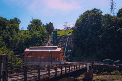
Great Falls, Historic Cotton Mill, & Dam
To see Great Falls, the Great Falls Dam, and the Historic Cotton Mill, we first enter the main portion of Rock Island State Park by driving through the village of Rock Island along Great Falls Rd. This small rural town was the first permanent settlement in Warren County, dating back to the early 1800’s. Situated over two peninsulas where the Collins, Rocky and Caney Fork Rivers meet, the area drew interest from early entrepreneurs looking to harness the water as a source of power. One of these structures, the Great Falls Dam and Hydroelectric Plant, dominates the scenery as you drive into the park on your RIGHT. As a filming location for the 1994 movie, “The Specialist”, Sylvester Stallone and James Woods can be seen setting up explosives to blow up a jeep on this dam and having one last epic fight on the lower banks of the Caney Fork River.
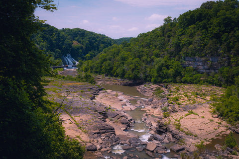
A small side road just off the main entrance veers RIGHT to an overlook of Great Falls just as you reach the Historic Cotton Mill. Here, you’ll find a small recreation area with restrooms, picnic pavilions, and the trailhead for the 0.50 mile Old Mill Gorge Trail. The Great Falls Cotton Mill (also called the Falls City Cotton Mill), located on the bluffs above Great Falls was originally built in 1892. A small town for the mill's workers, known as "Falls City”, sprang up around the operation. An earlier grist mill named the Bosson Mill, occupied this same spot towards the end of the Civil War, but was destroyed by a severe flood only a few years later. Entrepreneur after entrepreneur attempted to harness the Caney Fork's alluring power potential, only to eventually be defeated by the river's tendency to flash-flood every several years. In 1902, the company met the same fate as the Bosson Mill when the Caney Fork flooded again, destroying the mills wheelhouse and toll bridge. Soon after, the mill was abandoned and the town died out.
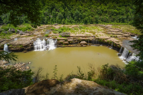
From the overlook, you can clearly make out the horseshoe shaped precipice of Great Falls at the bottom of the Great Falls Gorge. Even with the rivers water level low, this waterfall sustains three 30-foot plunges that can be seen year round. To see this waterfall up close, walk to the end of the parking area to the start of the 0.50 mile Old Mill Trail. This trail offers access to the Great Falls Gorge on the Warren County side via several steep staircases. From the bottom, visitors can rock hop all the way to the bottom of Great Falls and even swim in any number of swimming holes found here including the “Ice Hole” and “Warm Hole”. The Tennessee Valley Authority controls the water level of the Caney Fork River and typically leaves the water levels low enough for park visitors to enjoy. An important thing to note for all visitors is that water may rise rapidly without warning, so it’s important to monitor your surrounding while inside the gorge. If you do hear warning sirens, leave the gorge immediately.
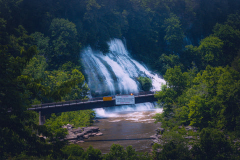
Twin Falls
There are several ways to see the amazing 80 foot tall Twin Falls, but if you want the full frontal image you’re going to have to go for a quick drive. Entrance to the Twin Falls Overlook Area is located along Power House Rd on the north side of the Caney Fork River. From the parking lot, walk to the bottom of the hill where you’ll see the Great Falls Dam Powerhouse and personnel bridge. Adjacent to the bridge, you’ll find the trailhead for the 1.6 mile Downstream Trail which follows along the very steep bluff line bordering the river. Known for its colorful spring wildflower displays, this trail features views of Blue Hole, Twin Falls, and the secretive Little Falls. Due to the heavy currents present all along this stretch of the river, swimming and wading is prohibited.
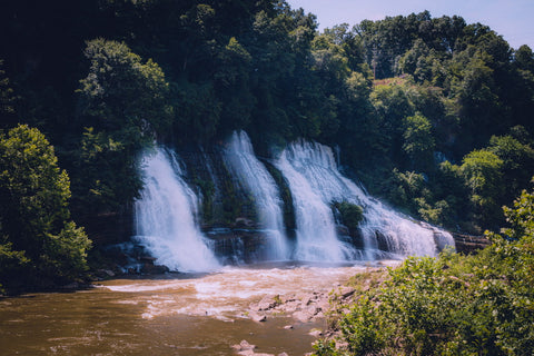
Walking down the freshly built staircase to the river bank, we could hear the roar of the rapids getting louder with each and every step. While it’s possible to just walk out onto the rocky shore and follow it to a suitable overlook of the falls, it’s much faster and safer to hike the dirt path. Along the way, you’ll come across several user-made paths wandering through the forest towards the river. Typically, the best views are found after hiking roughly 150 yards into the trail and then cutting LEFT to the falls. Reaching the river requires a steep scramble down through a boulder field. It’s not uncommon for people to stumble onto snakes sun bathing atop many of the rocks here so take extra precautions and watch your step.
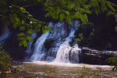
Most people are so captivated by the raw force and beauty of Twin Falls that it comes as a complete shock to them to discover that it is a “man-made” waterfall. The creation of Twin Falls was an unintended consequence of building the Great Falls Dam back in 1917. Spilling out from openings through and under the tree line covering the ridge top, this waterfall is unlike any other in the region. At the thinest point separating the Caney Fork River and Collins River is a section of hollow ridges rising hundreds of feet high. As the Collins River rose on the southern banks of Rock Island State Park, water began filling the dozens of caves underneath the ridge until finally finding a way out through pockets on the opposite side. The entire phenomenon came as a complete shock to the engineers who built the dam, but the effect quickly became a local sensation.
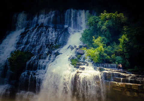
If you hike to the end of the Downstream Trail, you’ll find another smaller 75 foot waterfall called Little Falls. Its location is right near the Blue Hole, a popular location for kayakers to cast off into Center Hill Lake. Twin Falls is one of those spots that you can visit year round and catch completely different glimpses of depending on the season. As for us, we’re headed out on our way to the fourth stop on our waterfalls roadtrip. Check out our upcoming article as we explore the gigantic waterfalls of Fall Creek Falls State Park. Aside from being the most visited state park in Tennessee, it also contains several enormous waterfalls including its tallest, Fall Creek Falls. Stay tune and as always, see ya’ll on the trails!
Sources;


0 comments