

Being one of Kentucky’s four original state parks, Natural Bridge stands of one of the states crown jewels and a must visit destination for arch hunters, serious hikers, and outdoor enthusiasts alike. Originally built as a private tourist attraction, it was turned over to the state and became an official state park in 1926. One of the most scenic trails, filled with panoramic vistas of the entire area is the Laurel Ridge Trail. Running atop the rim of the cliffs of Natural Bridge, the Laurel Ridge Trail begins upon climbing “Fat Mans Squeeze”, travels past the ski lift to Lookout Point, and finally ends at Lovers Leap.
Laurel Ridge Trail | 0.75 Miles Out & Back
Natural Bridge State Resort Park | Trail Map
Natural Bridge State Resort Park | Google Maps
Earlier in the afternoon we made the 0.50 mile hike up the Original Trail to see Natural Bridge. The strenuous journey was filled with some of the most stunning woodland scenery in all of the Daniel Boone National Forest. After considering our options to continue sightseeing around the park, we decided to take the passage up “Fat Mans Squeeze” and walk around the top of the arch. This 30 foot long crack running the height of Natural Bridge is the fastest way to reach the top of the arch, if you don’t count the ski lift. The path is only wide enough for one person to traverse at a time and there’s usually a long queue of people waiting to go up or come down. It is one of the quirkiest parts of the whole park.

Upon taking the flight of stairs the rest of the way up past “Fat Mans Squeeze”, hikers will inadvertently begin their journey on the Laurel Ridge Trail. Stepping up onto the top of Natural Bridge, one gets a 360 degree view of the cliffs and canyon surrounding the area. There are no hand rails or protective barriers so extra precaution is needed, especially if you’re traveling with children.

On more than one occasion I spotted a few fearless visitors stepping onto the edge of the arch to take selfies, ignoring the 65 foot drop just inches from their feet. Because of the curved shape of the ledge, it’s impossible to see anything down below, so save yourself the trouble of becoming a pancake on the rocks.

Looking straight out across the canyon, we can see groups of hikers emerging from the ridge onto the bald crag known as Lookout Point. Go ahead and give a wave and chances are you’ll get an enthusiastic wave back. Before heading that way, take a moment to head back the in the direction you climbed up and follow the trail towards the massive shelter near the Sand Gap and Balanced Rock Trail junction. This Civilian Conservation Corps built log shelter is enormous and can easily fit 100 people. A few clearings in the forest surrounding it give you another perspective of Lookout Point and the canyon below.

It’s incredible to think that most of this was created as a private tourist attraction by the Lexington and Eastern Railroad back in 1895. The line was part of a major push by speculators to build a super highway for transporting cheap coal to Lexington, Kentucky from the coal fields of Bluefield, West Virginia. Initially guests had to pay a special fee to take a spur line up from the town of Slade to the cliffs below the arch.

Visitors were dropped off at a depot near hoe down island and directed to make the strenuous 1 mile climb up the Original Trail. Not much is known about Natural Bridges history predating this time as no major archeological excavations have been performed on the site. Some historical accounts mention local Native Americans treating the rock formation with contempt, referencing it as just a “hole in a wall”.

Taking a stroll back across Natural Bridge, we pass up a few large vistas as we head into the forested ridge on our way to Lookout Point. It’s an easy hike that trots along the edge of the massive sandstone cliffs that look down over the Battleship Rock Trail. Within a few moments, the trail became crowded from the mass of people waiting in line to get on and off the ski lift. Built in 1967, the ski lift is by far the most convenient way to see Natural Bridge. For a fee of $15, visitors can take a roundtrip to the top of the arch and back without breaking a sweat.

Most of this portion of the trail is shaded under a dense woodland canopy with the exception of several overlooks. The walk leaving the lift is typically pretty quiet and serene as most of the crowds head in the other direction towards the arch. After a few small rock scrambles, one emerges from behind the trees onto the large exposed ledge known as Lookout Point. This is easily the best view in the park and one of the best in the whole Red River Gorge Area. Natural Bridge sits dead ahead, with the dense forest canopy parting to expose the arch opening. It really does look like just a whole in a wall, but it’s a magnificent one at that.

After snapping several scenic photos, we continue forward to the end of the Laurel Ridge Trail at the Lovers Leap Overlook. At this point you might be one of the only hikers on the trail, as most people tend to skip this section. Its a peaceful walk far removed from what you’ll find near the more popular areas of the park for good reason. Just before arriving at Lovers Leap, you’ll run across two major junctions; the Devils Gulch and Needle Eye. These are the two infamously dangerous paths down from the top of Natural Bridge, which we will be tackling in just a few moments.

Go past these junctions and the wide, well worn trail slims down into a narrow footpath for the last 50 feet to the overlook. The drastic change made me wonder wether we were on an official trail anymore. The main overlook for Lovers Leap is straight ahead, while several scattered paths lead to smaller overlooks facing east and west. From Lovers Leap, one gets a commanding view of the canyon carved by the Middle Fork of the Red River.

In the foreground there’s a tall sandstone pinnacle that resembles a smaller version of Courthouse Rock along the Auxier Ridge Trail in Red River Gorge. Just past that one can make out the expansive compound of Miguels Pizza with several campgrounds stretching out around the climbing shop. Veering our gaze to the right is the entrance to the Whittleton Branch Campground, just above the bridge crossing into the main part of Natural Bridge State park.

Under the watchful gaze of several turkey vultures swooping overhead, we head back to reconnoiter the best way down to the Hemlock Lodge. The two main stairways, built by the Civilian Conservation Corps are only 30 feet apart, with Needles Eye being the closest to Lovers Leap. A married couple coming up the stairway, stopped to ask me for directions to Lovers Leap. Being the lighthearted individual that I am, I couldn’t resist ending our conversation by jokingly saying, “Whatever you guys do, just please don’t jump off, its not worth it”. They gave me a half hearted smile in response. Trail humor is hit or miss sometimes!

The Needles Eye staircase is made up of a long stretch of narrow fieldstone blocks, descending the cliff through a forested rock garden. There is nothing to hold onto and the tall, narrow steps can easily cause you to be off balanced. With that being said, it’s the easiest of the two ways down. The most challenging and outright dangerous path down is through the Devils Gulch. This treacherous path is simply on a whole other level. Carved out of the solid face of the cliff, the Devils Gulch traverses down a narrow box canyon at nearly a 90 degree angle.

It is so steep that one needs to either go backwards are lean back as they go down, while attempting to grasp at the thin metal railing at your side. Being carved out from the cliff, the stairs are constantly wet and slippery from water runoff traveling down the slope. This path is not recommended for anyone with mobility issues and if you chose to do this with children, keep a close eye on them.

There are two separate sections to this path. The first half is made up of the stone steps, with nowhere to really stop and take a break until one reaches a series of wooden staircases, juxtaposed in different angles all the way to the bottom of the ravine. Once you reach the first wooden landing, you can finally turn around and look up at the insanity that you chose to travel down.

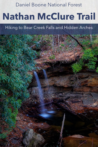
What is hard to notice while you’re climbing down, is all of the interesting rock formations and overhangs scattered throughout this box canyon. Near the very bottom landing, if you look to the right, there are a half dozen tiny arches (also called windows), carved into the side of the cliff. If you wander over to your left, you’ll discover a wet weather waterfall streaming over one of the largest rock shelter overhangs in the entire park.

Now we have two choices for getting back to the lodge, the scenic path and the straight shot. Looking straight ahead down the hill with the Devils Gulch at your back is the 0.5 mile straight shot to the Hemlock Lodge. Its a mostly downhill walk with a few scenic creek crossings until you reach a dead end at the Rock Garden Trail and hang a quick right to merge back onto the beginning of the Original Trail.

If you have some time, its well worth taking the scenic route back along the Battleship Rock Trail. With the Devils Gulch at your back, turn RIGHT at the bottom of the stairs and follow the trail below the bluffs of Lookout Point to Battleship Rock and loop back onto the Original Trail. You’ll have the choice of either traveling back to see Natural Bridge or bypass it via a small shortcut to the Hemlock Lodge, making it a 2.50 mile trip from your start at Fat Mans Squeeze, to Lovers Leap, past Battleship Rock, Natural Bridge, and back to the parking lot.

It still boggles my mind that it took me so long to visit this gem of a state park in my own back yard, but better late than never. There are so many scenic trails here like Rock Garden, Hoods Branch, and Sand Gap that I need to make a return trip to explore. But before then, I’ll be taking an extended trip to the Hocking Hills region of Ohio to explore the legendary trails of Hocking Hills State Park. Spread out across an entire county, the half dozen recreation areas of Hocking Hills are known as the best hiking destination in all of Ohio. We’ll be starting our adventures just outside of the state park by visiting the largest natural bridge in Ohio, Rockbridge Natural Bridge in the Rockbridge State Nature Preserve. Stay tuned for our upcoming article and until next time, see y’all on the trails!


0 comments