Midnight Hole, Midnight Hole Falls and Mouse Creek Falls are three gorgeous waterfalls that can be found on one of the largest and most scenic mountain watersheds in the North Carolina portion of the Great Smoky Mountains National Park. Easily reached from a 2.0 mile hike on the Big Creek Trail, this family friendly hike follows along the many waterfalls and boulder filled cascades of Big Creek. Tucked away in a quiet part of the park, there are countless opportunities along this trail to take in the picturesque scenery of one of the less visited parts of the Smokies. Located just inside the North Carolina state line off I-40, the Big Creek access area was initially developed in the 1930’s as an alternate entrance into the national park.
Big Creek Trail to Midnight Hole Falls | 1.5 Miles
- To Mouse Creek Falls | 2.0 Miles
Big Creek Trail Map | Alltrails
Great Smoky Mountains National Park Trail Map
Big Creek Trailhead Location | Google Maps
 Approximate route to Midnight Hole, Midnight Hole Fall and Mouse Creek Falls along the Big Creek Trails in Great Smoky Mountain National Park.
Getting There
The Big Creek Access Area of the Great Smoky Mountains National Park is one of the least talked about regions of the Smokies. Too far out of the way for most weekend vacationers in Gatlinburg or Pigeon Forge to visit, this area is a sought out refuge of near pristine wilderness and solitude for locals and dedicated hikers. Located in an isolated valley just across the state line in North Carolina, visitors can reach this area by taking a 12- mile drive from Cosby to Big Creek along Highway 32 towards Mount Sterling or take I-40 towards Asheville to Exit 451/Waterville Rd. Entering the park along the mostly gravel Big Creek Entrance Road, drive all the way to the end of the road where you’ll find a dead end loop where the parking lot is located. Protected by the nearby Big Creek Ranger Station, this recreation area is equipped with restrooms, several picnic areas, and a 12-tent campground.
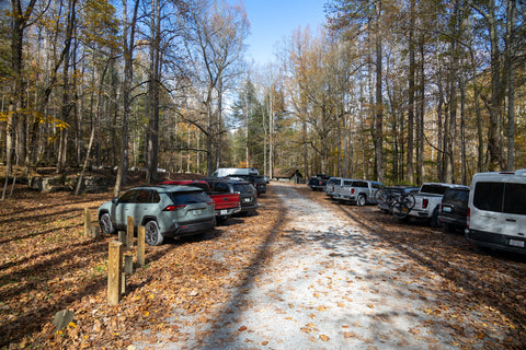
Parking lot for the Big Creek access area of the Smoky Mountains on the North Carolina side. This is one of the most isolated sections of the National Park And sees very few visitors.
Big Creek Trailhead (2.0 Miles)
Just before reaching the parking lot, you will pass the Big Creek Trailhead on your right. It is a 50 yard walk from the restrooms, back up the road from the direction you came in, to a small trailhead sign. While the 10.5 mile Big Creek Trail stretches deep into the headwaters of its namesake waterway near Walnut Bottom, we will only be hiking a little over a quarter of that length to reach both of today’s destinations. Mostly level, wide, and easy to navigate, this trail will slowly descend closer to the banks of Big Creek the further we go, allowing us to eventually get up close to Midnight Hole Falls, Midnight Hole, and Mouse Creek Falls.
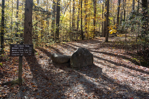
From the trailhead it is a straightforward hike 1.5 miles to Midnight Hole & Midnight Hole Falls, plus an extra 0.5 mile to Mouse Creek Falls.
The Big Creek access area owes its current existence to the Pigeon River Logging Company during the early 1900’s. As the Tennessee and North Carolina Railroad Company laid tracks to the Mount Sterling Post Office (right where you enter the Big Creek access area off Waterville Rd), this openend up opportunities in what was once considered the most remote part of the Smokies. In order to access Big Creek, loggers cut a path from Mount Sterling and laid down railroad tracks all the way to the large clearing where the picnic area and parking lot rests today. A small settlement known as Crestmont sprung up at this location, which included homes, a rail depot, and a lumber mill whose foundation can still be seen inside the parking area. Over the course of 20 years of logging, the railroad was expanded further south along Big Creek into Walnut Bottom 5 miles away.
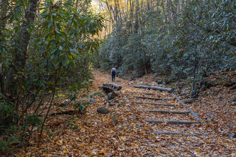
During the logging boom of the 1910’s, Big Creek Trail was actually a narrow gauge rai line used to haul lumber to Mount Sterling from Walnut Bottom.
When the National Park Service took ownership of the land in 1930, the Civilian Conservation Corps was brought in to remove the railroad and use the existing foundation as a roadway for an eastern entrance into the new National Park. While the original plan was to build a road that could access deep into the interior of the park past Walnut Bottom, the plan was eventually abandoned. In its place, they turned miles of preexisting rail lines and roadways into hiking trails which includes the Big Creek Trail. This history repeats itself for most of the major trails in the Great Smoky Mountains National Park, including a recent hike on the Middle Prong Trail to Lynn Camp Prong Cascades.
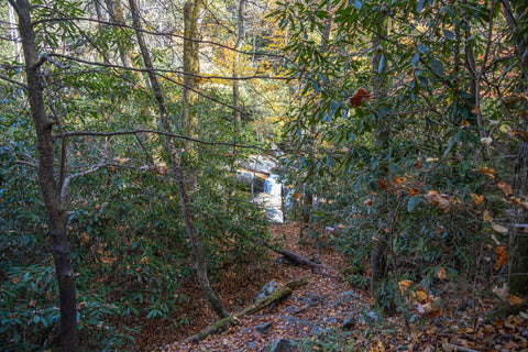
Side path from Big Creek Trail to Midnight Hole Falls at the 1.3 mile mark.
Midnight Hole Falls (1.5 miles)
Midnight Hole Falls is roughly 1.5 miles away from the trailhead and the first of this trails main waterfalls. While the Big Creek Trail seems to initially ascend slightly up the banks of Big Creek, it eventually makes a steady descent to our first waterfall destination. There are a lot of small rapids just before reaching it, but this one will immediately catch your attention. Upon hearing the crashing roar of the falls, you should see a large, well made path on your LEFT leading to the creek. Exiting out onto Big Creek, you’ll be welcomed by a sprawling 8’ feet tall, multi-tiered waterfall.
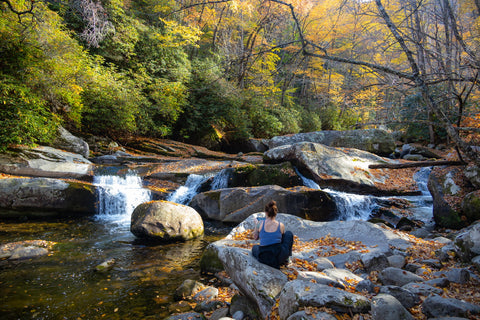
It is not commonly advertised that Midnight Hole is actually two separate waterfalls. This is the 8’ft tall Midnight Hole Falls with “Midnight Hole” proper a five minute walk upstream.
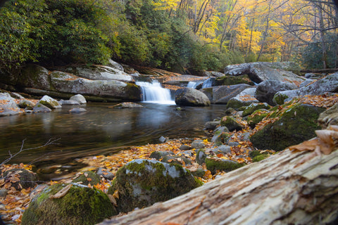
Midnight Hole Falls is also locally referred to as Bettis Branch Falls for the tributary that feeds into Big Creek directly behind the falls.
What most people get wrong about “Midnight Hole” is that it is actually two separate waterfalls. The popular swimming hole, Midnight Hole is a five minute walk further up the trail. Midnight Hole Falls is its smaller sibling and typically devoid of crowds, making it the perfect place to sit and enjoy a peaceful moment. Giving it an extra “oomph’ of power, Bettis Branch flows down the mountainside and directly funnels into Midnight Hole Falls, which is also sometimes referred to as Bettis Branch Falls. This waterfall has a lot of personality and can take on many different looks depending on which vantage point you shoot it from. Spanning over 20 feet wide, the creek splits off in several directions as it weaves around, over, and under a pile of large boulders near its precipice, giving it a lot of character.
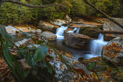
One of the more photogenic waterfalls in the Smoky Mountains, this waterfall takes on many different looks depending on which angle you shoot it from.
Midnight Hole (1.6 miles)
After leaving Midnight Hole Falls, jump back on the trail and walk a few minutes further until you spot the small wooden sign marked “Midnight Hole” on your left. It is easy to spot and directly behind it there will be two separate trails leading down to the swimming hole. Even on a brisk fall day there were a handful of people taking a dip in the creek. You will have to scramble down an embankment of boulders to get to the pebble beach and see the waterfall up close. Big Creek flows over an enormous set of rock monoliths at this location where the creek bed suddenly caves in forming a massive, circular, dark hole. Hence the name.
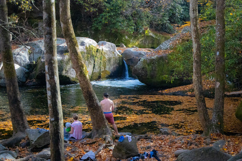
The Midnight Hole. This is the popular swimming hole everyone thinks of when they undertake this hike. Even with the temperatures in the low 60’s people are still taking a dip in the creek.
Aside from the larger-than-life rock formations, this noteworthy waterfall is famous for having two small falls at 6 ft and 8 ft tall draining into the Midnight Hole. Despite Midnight Hole Falls having a nice run a little downstream, Midnight Hole looks like a small spout today. Pay it a visit after a heavy rain though and there will be a full on running cascade here that resembles Abrams Falls on the western section of the park. People typically take to climbing the boulders and jumping off into the pool directly below the falls, which is the deepest section of the entire length of Big Creek. When not covered by falling leaves, the water at Midnight Hole is so crystal clear on sunny days that you can nearly see all the way to the bottom.
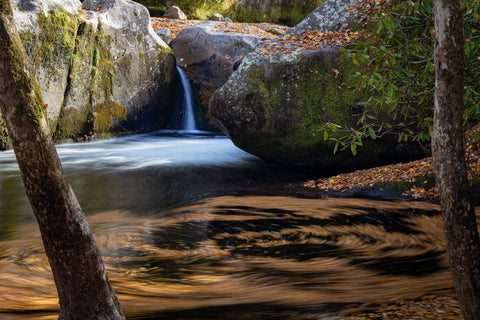
Though hard to see from this angle, the Midnight Hole is a double waterfall with a 6’ft and 8’ft falls dropping into the large swimming hole here.
Mouse Creek Falls (2.0 miles)
Finishing up our visit to the Midnight Hole, we push on for the last 0.5 mile of the trip to see Mouse Creek Falls. Heading deeper into the headwaters of Big Creek, the valley narrows at this point with the dense forest canopy shading out even the brightest afternoon sky. This is typically where the crowds fade away as most visitors to the swimming hole rarely venture this far. As we near the 2.0 mile mark of our journey we start looking for the side trail that should dart off to the LEFT of the main trail. Most online trail guides suggest keeping an eye out for a horse tie off, which marks the correct path. Something to keep in mind is that Big Creek is first and foremost a bridal trail and horseback riders DO have the right of way here.
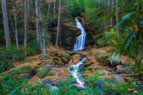
The 45”ft tall Mouse Creek Falls rarely disappoints with its year round flow. Mouse Creeks headwaters can be traced several miles up to the summit of Mount Sterling and contains a difficult to reach Upper Mouse Creek Falls section.
After wandering down a path, we entered a large clearing with the aforementioned horse tie-off, and a little further ahead found exactly what we came here to see. Mouse Creek Falls has to be one of the most gorgeous waterfalls in all of the Smokies. Like a miniature version of Spruce Flats Falls, this 45’ feet tall gem has three distinctive drops. With the first 5’ foot tall section completely out of sight from our vantage point, we get a front row seat to its 30’ foot middle drop as it majestically empties into a natural pool. The thin veil of water, caressing every nook and ledge as it makes its way down, is standard form for waterfalls found in North Carolina. From the pool it follows a 10’ ft long series of cascades down the hillside where it finally joins Big Creek.
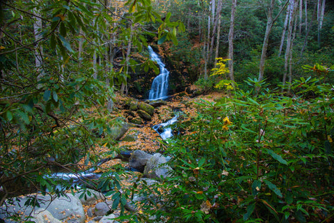
Some visitors opt to cross Big Creek at this spot to see Mouse Creek Falls up close. Any attempt at a stream crossing should only be made when the water level and flow are low… unlike today.
If the water level is low enough, visitors are known to attempt a stream crossing at this point to see the upper falls much closer. With a framed view of Mouse Creek Falls this good from where we’re standing, it is hard to imagine it looking any better. Up next, we are leaving the Great Smoky Mountains National Park and heading south to the Blue Ridge Parkway to see Woodfin Falls Cascades. Anywhere from 100’-300’ feet tall, Woodfin Falls might be one of the tallest waterfalls in North Carolina. Barely visible from the distant Mount Lynn Lowry Overlook, you can actually stop and view the very top of this waterfall up close at the Woodfin Cascades Overlook on Milepost 446 of the Blue Ridge Parkway. Stay tuned for this upcoming article and as always, see y’all on the trails!


0 comments